LiDAR Wind Measurement Nussdorf – Erl
Implementing cross-border wind measurements
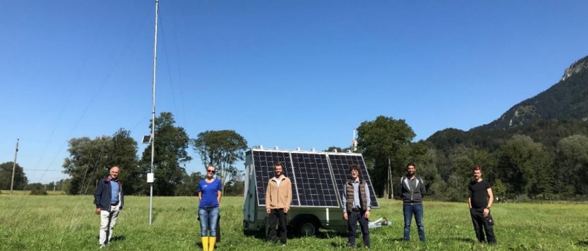
Over the span of two year, a stationary sensor (15 m height) in the valley constriction near Schwaigen has already provided evidence for excellent wind conditions. In addition, an idealized meteorological simulation by Zängl 2004 predicts that the wind field extends several more kilometers north into Bavaria and the Rosenheim basin. To investigate this further, a detailed measurement of these winds using LiDAR is called for. The cross-border nature of the phenomenon gives rise to cross-border synergies and cooperation.
Aims and objectives
The aim of the project is to record the entire wind field in its spatial extent (north-south, east-west) and vertical thickness between Nußdorf (Germany) and Erl (Austria) using the method of LiDAR wind measurement.
Further, the project intends to create awareness among the local population both for the energy-generating potential of these winds and for the optical and acoustic effects of wind turbines.
A third objective is the preparation of an INTERREG project proposal that would aim to create cross-border competence with a view to the analysis of potential wind power sites in the Alpine region.
The project’s objectives align with Austria’s national energy and climate strategies. Tyrol, for example, has the goal of generating 250 GWh of electricity per year from wind power by 2050. So far, however, there is not a single wind power site in all of Tyrol. The same applies analogously to the Rosenheim district in Germany.
Project Milestones
- Comparison of results from stationary measurements (masts) on both sides of the border
- LiDAR measurements at sites on both sides of the border
- Evaluation of LiDAR measurements and correlation of the different sites
- Site evaluation of wind power potential in the border area
- Bus trip to raise awareness among all stakeholders about wind power sites
- Joint scientific publication